I mentioned in my last post, that I use a website called MapMyRun for getting a good idea of how far my run routes will be before I do them. I also mentioned that adidas’ micoach offers a similar solution, so why do I use MayMyRun?
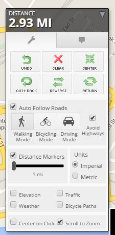
The biggest plus for MMR is the intelligence within the route planning tool. If you were to click in your starting location and then click a second time at your finishing destination the route planning tool will create you a path that follows roads, using its Auto Follow Roads feature; something that micoach (unfortunately) cannot do.
In micoach, if you were to click in your starting location and then again in your finishing location, it will completely ignore roads and give you a route of how the crow flies. This makes routes with plenty of corners, twists and turns an absolute nightmare to plan, having to click a large amount of times to set your route, whilst MapMyRun, allows you to simply guide the planning tool where you want your route to go.
Of course, there is an advantage to the crow-flying approach. Triatheltes who would want to use MMR need not worry. The Auto Follow Roads feature can be switched off.
The only downside to MMR is including alley-ways and public footpaths. Although I was pleasantly surprised to see that MMR makes full use of Google Maps, they would never be able to cater for every single alley-way in the country and this can sometimes be frustrating. For example, running along Bexhill seafront is a great place to add to your route, but in MMR if you take the promenade, you can’t get off! This is something you have to work around, but it’s not a show-stopper for me.

Bexhill promenade in “real life” merges onto W Parade. Making it difficult to plan an accurate route.
Finally, I’m just going to mention the tools available in MMR that are available along with Auto Follow Roads.
There are a couple of good tools here. The Undo button is a life-saver and the Return feature is also very handy. You can return to your starting location from anywhere along your route using the shortest distance. Distance markers are also quite handy and can be modified to imperial or metric units specifying the distance between each one. It is also possible to the grades of elevation throughout your route by ticking the box for Elevation.
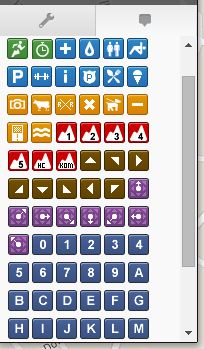
The last feature are the stickers. These cover things such as water, graded elevations, start and finishing lines, spring zones, numbers for mile markers or anything you want them to be. These can be dragged and dropped anywhere onto the map.
Once you have completed your route, you can save it, share it and run it!


